Moving Mountains
Carving the landscape of southwest Montana.
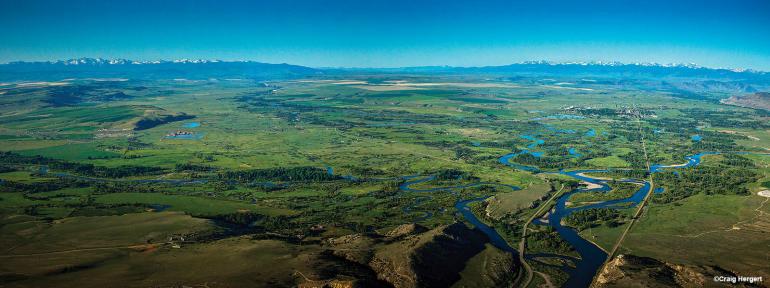
In our past three issues we’ve looked at three different mountain ranges of southwest Montana, each formed by a different process. We’ve seen rocks nearly as old as the Earth itself in the Beartooths, traced our way through the time capsule of the Bridgers, and gazed up at ancient volcanoes in the Gallatins. There’s something missing, though—what about the spaces in between? After all, valleys and canyons are just as integral a part of our landscape as mountains. How did these massive swaths of land become gouged out of the uplifted mountains? Turns out, just like with mountain ranges, there are many different answers to that question, resulting in a variety of landforms—from the broad, sweeping Lamar Valley to confined, narrow Gallatin Canyon. The study of changing landforms on Earth’s surface is called geomorphology.
You probably already know that canyons and valleys are created by weathering and erosion, but let’s “break down” those terms a bit further. Weathering is the process of splitting bedrock into smaller pieces, which can occur on scales from massive rock slabs shearing away from cliffs, to microscopic bonds breaking inside molecules. We divide weathering into two categories: mechanical and chemical. Mechanical weathering is the physical breaking apart of rocks by freeze-thaw cycles and abrasion, whereas chemical weathering refers to minerals within the rocks dissolving in a solution—usually water, especially acidic water (more on that shortly). Mechanical and chemical weathering play off of each other. As rocks are weathered mechanically, more surface area is exposed for chemical weathering. Conversely, as minerals are dissolved away from a rock, the rock becomes softer and more susceptible to mechanical weathering.
Weathering doesn’t only shape Earth’s surface—in fact, chemical weathering is also responsible for regulating the planet’s climate, like a built-in thermostat. These dissolution reactions happen faster at higher temperatures, and additionally, as carbon dioxide accumulates in Earth’s atmosphere and is absorbed by rain, the rainwater becomes more acidic. When minerals are dissolved by this acidic water, the carbon dioxide is carried along and eventually buried in the deep ocean, reducing the amount of carbon dioxide in the atmosphere. This will eventually cool down the planet. It takes a long time—millions of years—and will certainly not curb the effects of human-caused climate change anytime soon; but it’s the reason why life on Earth has been able to recover from climate catastrophes and subsequent mass-extinctions in the past.
Speaking of changing climate, let’s move onto erosion: the process of transporting weathered rocks by a fluid. This “fluid” can be any substrate: not just water, but also ice or wind. Currently, in Montana, the fluid most often is water, as our few remaining glaciers are rapidly retreating and our climate, though dry, is not dry enough for significant sand and dust storms. But in the past, during ice ages as recent as 20,000 years ago, glaciers covered the landscape here. You know about the massive U-shaped valleys in Glacier National Park, the Beartooths, and even Hyalite Canyon. If you look a bit closer, you’ll find moraines: jumbled masses of rocks remaining after a glacier has run its course through a valley. These are visible in Hyalite near Langohr Campground and alongside the reservoir, each from a different ice age. You’ll know you’re looking at a moraine if you find rock debris of all different sizes, from massive boulders to fine silt—glaciers don’t care what’s in their way; they’ll pick up and entrain everything they encounter.
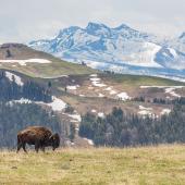
Water, on the other hand, is more selective. Or rather, the energy of the moving water directly determines the size of debris that it carries. This is why we find heaps of house-sized boulders—like House Rock—in fast-moving sections of water such as the Mad Mile, collections of cobbles in moderate currents among the riffles of the Upper Madison, and fine sands and mud in the slow, meandering waters around Three Forks. Due to Montana’s rugged landscape, most waters fall on the higher-energy end of the spectrum, so most of the finer sediments are carried farther down the Missouri watershed and deposited in the flat, fertile lands of the Midwest. But occasionally, massive floods caused by fluctuations in climate will cause rivers to spill over their banks into the surrounding plains, where the water will move slowly and deposit a layer of soil just thick enough to grow grasses for grazing livestock. A striking example of these floodplains is found in the Lamar Valley, where flat terraces spanning a couple hundred yards formed by flood deposits are interrupted by steep embankments carved away during drier spells.
So there you have it: a crash-course on geomorphology to cap off our four-part geology series. You can see the effects of geomorphology everywhere in Montana and start thinking about the various mechanisms that have formed our landscape. Look from afar, look up close, or even start digging around, and you’ll find clues as to where our mountains, hills, valleys, and canyons have come from in the geologic past. You can start pestering your friends on hikes and river trips about the evidence of weathering and erosion around you. You may get left behind or dunked in the water if you ramble too long, but that’s okay—all good things take time, including the shaping of Montana’s magnificent landscape.
Jack Taylor gets his rocks off on rocks.

