Skip to main content
Main navigation
Activities
Skiing
Fishing
Hunting
Hiking
Camping
Biking
Boating
Climbing
Running
Miscellaneous
Trails & Tours
Biking Trails
Hiking Trails
Nordic Trails
Ski Tours
Backpacking Trips
Gear
Product Reviews
Care & Maintenance
Do-It-Yourself
Company Profiles
Contests & Giveaways
Events
Sports & Competitions
Clinics & Seminars
Art, Music & Food
Misc. Events
OutPost Newsletter
Training
Workouts
Nutrition
Injury Prevention
Skills & Safety
More
Culture
People
Dogs
Books
Humor
Conservation
Food & Drink
Arts & Culture
The New West
Around the Bozone
More
Store
Publications
Swag & Snark
Events
Advertising
Classifieds
More
Places
Road Trips
Maps & Guidebooks
Groups & Clubs
Podcast
The Magazine
Contests & Giveaways
Subscribe
About
Contact
Log in
0
Search
Main navigation
Activities
Skiing
Fishing
Hunting
Hiking
Camping
Biking
Boating
Climbing
Running
Miscellaneous
Trails & Tours
Biking Trails
Hiking Trails
Nordic Trails
Ski Tours
Backpacking Trips
Gear
Product Reviews
Care & Maintenance
Do-It-Yourself
Company Profiles
Contests & Giveaways
Events
Sports & Competitions
Clinics & Seminars
Art, Music & Food
Misc. Events
OutPost Newsletter
Training
Workouts
Nutrition
Injury Prevention
Skills & Safety
More
Culture
People
Dogs
Books
Humor
Conservation
Food & Drink
Arts & Culture
The New West
Around the Bozone
More
Store
Publications
Swag & Snark
Events
Advertising
Classifieds
More
Places
Road Trips
Maps & Guidebooks
Groups & Clubs
Podcast
The Magazine
Contests & Giveaways
Subscribe
About
Contact
Breadcrumb
Home
Trails & Tours
Hiking Trails
Hiking Trails
Trails & Tours
:
Trails
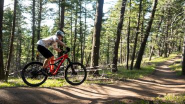
Chestnut Mountain Trail
Trails & Tours
:
Trails
South Cottonwood Trail
Trails & Tours
:
Trails
Bozeman Creek Trail
Trails & Tours
:
Trails
Kirk Hill Trail
Trails & Tours
:
Trails
Bear Canyon Trail
Trails & Tours
:
Trails
Middle Cottonwood Trail
Trails & Tours
:
Trails
Bear Trap Canyon Trail
Trails & Tours
:
Trails
Triple Tree Trail
Trails & Tours
:
Trails
Drinking Horse Mountain Trail
Trails & Tours
:
Trails
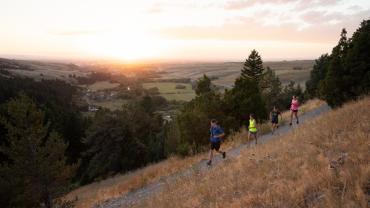
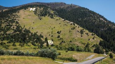
M Trail
Trails & Tours
:
Trails
Sypes Canyon Trail
Trails & Tours
:
Trails
Truman Gulch Trail
Trails & Tours
:
Trails
Storm Castle Peak Trail
Trails & Tours
:
Trails
Pine Creek Lake Trail
Trails & Tours
:
Trails
Blackmore Lake Trail
Trails & Tours
:
Trails
Emigrant Peak Trail
Trails & Tours
:
Trails
Bangtail Divide Trail
Trails & Tours
:
Trails
Leverich Canyon Trail
Trails & Tours
:
Trails
Ousel Falls Park Trail
Trails & Tours
:
Trails
Lowercase "m" Trail
Pagination
Current page
1
Page
2
Page
3
Next page
Next ›
Last page
Last »
Popular This Week
Trails & Tours
:
Trails
Ousel Falls Park Trail
Trails & Tours
:
Trails
M Trail
Trails & Tours
:
Trails
Fairy Lake Trail