
Bozeman's favorite.
After a successful ascent of Mount Blackmore in 1872, members of the Hayden Survey were very intrigued by the craggy gorge at the head of Middle Canyon, which is today’s Hyalite Canyon. Geologist Albert C. Peale, best known for his exhaustive study of Yellowstone geothermal features, wrote:
The following morning we followed Middle Creek to its sources, and found that the valley abounded in most magnificent scenery, foliage, rocks, and numerous water-falls and cascades coming in to form the most beautiful pictures, and Mr. Jackson concluded to remain several days in the valley.
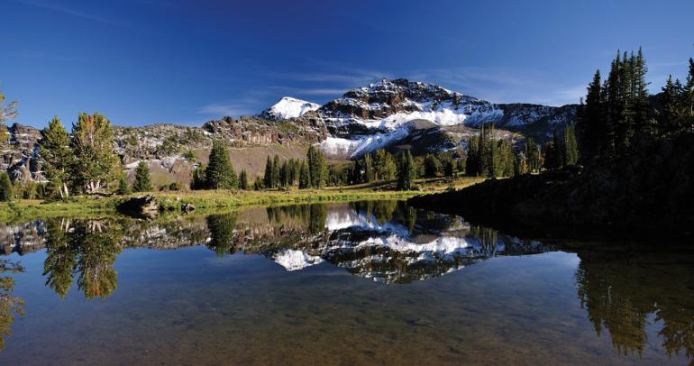
Hyalite Peak is the second-highest peak in the northern Gallatin Range (Mounts Bole and Chisholm are the highest), and it occupies the southern apex of the vast U-shaped Hyalite headwaters. Hyalite Peak’s gentle triangular shape and large north-facing snow bowl are plainly visible from Hyalite Reservoir, beckoning skiers and hikers to make the approach. Today, two excellent pack-trails run from Hyalite Canyon into Squaw and Swan creeks. The trail into Swan Creek crosses directly over the summit of Hyalite Peak, the monarch of Hyalite Canyon.
Peale and his comrades had designs on crossing the divide at the head of Hyalite Canyon and descending today’s Squaw or Swan creeks to rejoin the main party in Gallatin Canyon. But cliffs and steep slopes at the rim of Hyalite seemed impassable for horses, and so they were inclined to retrace their steps to Bozeman. These men were among the first Euro-Americans to see this beautiful basin, and William Henry Jackson might have ventured onto the summits during his extended visit.
The name “Hyalite Peak” originally appeared on Frank Tweedy’s 1886 Three Forks map in the position of today’s Steamboat Mountain some 12 miles to the south. The name was removed on the 1893 Livingston quadrangle and finally placed where we see it today on a 1934 reprint of that same map.
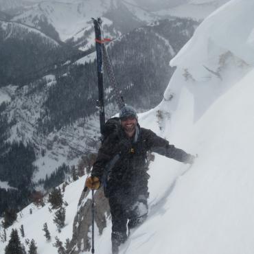
Ascent: Follow Hyalite Canyon Road as you would for the approach to Mount Chisholm. Instead of turning left into the east fork, continue driving another 2.5 miles to Hyalite Canyon trailhead near the Palace Butte campground. Follow this excellent trail past several trail junctions and waterfalls to the summit of Hyalite Peak
Vitals
Hyalite Canyon parking elevation: 6,920 feet
Elevation gain: 3,378 feet
Distance: approximately 7 miles
Overall grade by northwest ridge: II Class 1
Estimated ascent time: two to five hours
Maps: Fridley Peak
This article and imagery is adapted from Select Peaks of Greater Yellowstone.
45.37946743299, -110.96124652249