Fall Floatin’
A southwest Montana mosey.
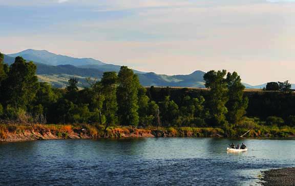
Looking for a quiet fall float and some great scenery? Try the Jefferson River, starting from the Cardwell Fishing Access Site (FAS), 60 miles west of Bozeman just off of I-90 at exit 256. The float starts in farm country lined with cottonwoods and cow pastures and then quickly turns into a scenic limestone canyon as you float downriver toward Lewis & Clark Caverns State Park.
The Lewis & Clark Expedition dragged their dugout canoes upriver through this canyon in July of 1805. William Clark shot a bighorn sheep on the reddish hill seen on river right as you enter the canyon. The limestone that makes up the dramatic canyon cliffs formed during the Mississippian Period 340 million years ago, when the area was covered by a warm, shallow sea. The carbonaceous shells of countless microscopic organisms accumulated to great depths over time to form the limestone. Small marine fossils are also abundant in the rock. Geologic uplift eventually raised the limestone above sea level, and rainwater moving through fractures in the limestone dissolved some of the rock, forming the caverns.
Parts of the canyon were impassable until the completion of the Northern Pacific Railroad in 1890. Placer gold deposits were discovered in the canyon at about this time but were too high above the river to use the water for washing the gravel. Instead, gold miners built a six-mile ditch to bring water in from the South Boulder River. The ditch entered the canyon through a tunnel not far from the point where Clark shot the bighorn sheep, and it remains a horizontal scar across the hill today. Wooden flumes were built across the cliff faces to bring water downstream to placer workings. Nothing remains of the town today.
Along the way, you can’t miss the big cave on the left, where limestone was quarried for the smelters in Butte from 1900 to 1935. On the right side, you will see the railroad bed leftover from the Chicago, Milwaukee, St. Paul, and Pacific Railroad, which was built through the canyon in 1908 and operated until the line was abandoned in the 1980s.
A good half-day float ends at the Limespur FAS, seven river miles downstream from Cardwell and just up-canyon from Lewis & Clark Caverns State Park. Plan on visiting the cavern while you are in the area. Arrowheads inside the cavern reveal that Native Americans knew about it first, though the cave system was rediscovered in 1892 and became Montana’s first state park in 1937. The 3,000-acre park features numerous scenic trails, which are great for year-round hiking and mountain biking.
A full-day float takes you another seven miles downstream through the rest of the canyon to the Sappington Bridge FAS. Be sure to bring a trash bag to help pick up any litter you find along the way.
Tom Elpel is president of the Jefferson River Canoe Trail (JRCT), a chapter of the Lewis & Clark Trail Heritage Foundation. For maps of the Jefferson River, including a day-by-day history of Lewis and Clark on the river, send $20 to the JRCT at JRCT, P.O. Box 697, Pony, MT 59747. To subscribe to the JRCT discussion group, email [email protected].