Town Trails


Highland Glen

Painted Hills
Drinking Horse
Peets Hill

M Trail

Highland Glen

Painted Hills

Peets Hill
Drinking Horse

M Trail
A guide to Bozeman's byways.
Around Bozeman, trailheads are everywhere—but did you know that dozens of trails run right through town? They’re part of the Main Street to the Mountains trail system, and you can hop on these in-town trails nearly anywhere. Whether you’re sneaking in a mid-day run or a half-day biking excursion, here are a few options to consider.
The Gallagator
This trail connects Bogert Park and Peets Hill to the MSU campus on the south end of town. It follows Bozeman Creek for much of its length, passing the Langhor gardens and climbing boulder along the way. Numerous access points exist along the length of this trail; the main one is at the base of Peets Hill.
Peets Hill
If you’re on a quick jaunt or dog-walk on the Gallagator, be sure check out Peets Hill. It’s not only a popular spot to gaze out over the valley, but offers sledding in the winter and picture-perfect sunsets year-round. Peets Hill also makes a great jumping-off point, as it connects to Lindley Park and the Highland Glen trails.
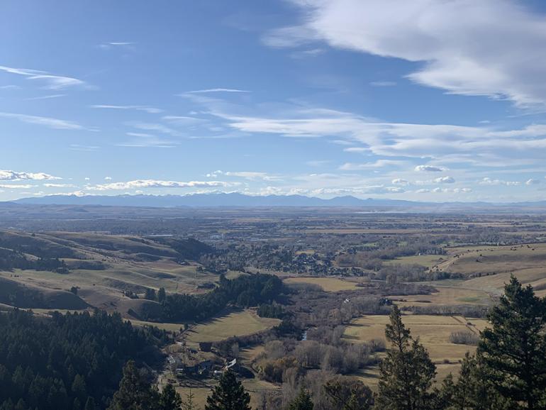
Highland Glen
A newer addition to Bozeman’s trail system, Highland Glen Nature Preserve offers singletrack for bikers, runners, and dog-walkers alike. It has three access points: at the sports complex off Haggerty Ln., via Hyalite View Trail above the hospital, and near the Painted Hills trailhead off Kagy. These trails are groomed in the winter for cross-country skiing.
East Gallatin Rec Area
This easy trail meanders around Glen Lake and through thick forest along the East Gallatin River. This is the perfect spot for a quick mid-day lap or a leisurely day spent in the water and sun. Once you’ve worked up an appetite, amble over to Map Brewing for some grub and a growler.
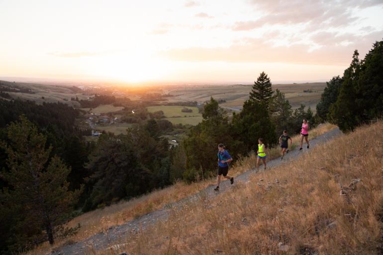
M Trail
At the mouth of Bridger Canyon is the landmark M, created by Montana State University students in 1915. There are two routes to the M from the trailhead. A steep, direct path branches right at the first junction, where an easier and longer ascent makes a hard left. This trail is very popular—the views of the Gallatin Valley are spectacular, and hikers use the trail as a lunchbreak loop or out-and-back. There's even a paved path running from town to the M Trailhead, so you needn't have a vehicle to get there.
Drinking Horse
Drinking Horse Mountain is the prominent hill across from the M. Its trail starts out meandering along the fish hatchery to a bridge over Bridger Creek, after which a junction presents two options. Going left puts you on a steeper ascent, with multiple switchbacks and plentiful shade. The path to the right is longer and more gradual, with open views of the Gallatin Range. Drinking Horse is a dog-friendly trail; however, keep in mind the high density of people and pups when deciding whether to let your dog off the leash.
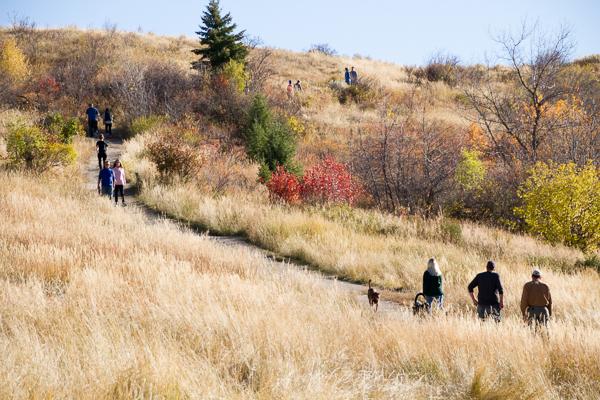
Painted Hills
Right off Kagy, Painted Hills climbs gradually through tall grass with just a few switchbacks. It'll take you out to Triple Tree if you're looking for a longer hike, bike, or run. Enjoy the flowing descent on nice dirt coming back into town; just be mindful that this trail passes through several residential areas.
Link-Ups
These trails are all connected as part of the Main Street to the Mountains trail system. Take a gander at the GVLT Trail Map to plan a route weaving throughout the Valley. With 80+ miles of trails in the system, you're sure to get your fill.