The Forest Service's Juggling Act
Q&A with Becki Heath.
National forest travel planning has become a flashpoint in our society’s cultural rifts, with both sides claiming the moral high ground. Piston-powered visitors take to the streets, waving the flags of Liberty and Freedom. Muscle-propelled visitors insist environmental concerns obligate the U.S. Forest Service to implement real limits on motorized use, which has an unfortunate tendency to disturb wildlife, soil, water, and other forest visitors.
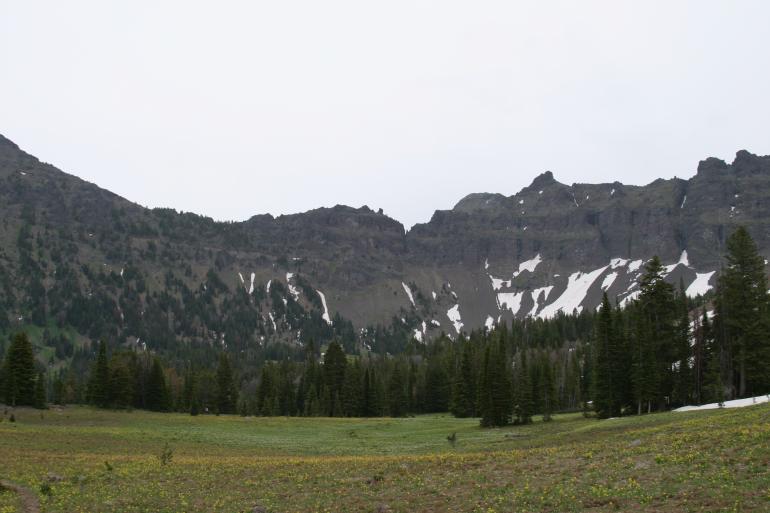
Struggling to balance the competing visions and interests associated with public-land recreation are land managers like Becki Heath, a 25-year U.S. Forest Service employee who heads up management of the Gallatin National Forest (GNF). After years working in the forests of the Pacific Northwest, Heath moved to Bozeman as a Forest Supervisor in September 2001. She soon found herself stirring the boiling cauldron known as Travel Plan revision, which will guide recreation management on the GNF’s 1.8 million acres that span six mountain ranges around Bozeman and Livingston.
In a belated effort to manage off-road motorized use and its myriad impacts, the Forest Service has begun a systematic revision of our national forests' Travel Plans. More than 20 national forests in the Northwest and Northern Rockies are currently revising their plans. Travel planning is an attempt to correct imbalances created by the explosion in motorized recreation over the past decade, officials say. The Bush-appointed Forest Service Chief Dale Bosworth and his Clinton-era predecessor Mike Dombeck have fingered “unmanaged recreation” as a leading threat to our national forests.
Under Heath’s leadership, the GNF issued a draft Travel Plan last February that would close some terrain to motors, as well as ban mountain bikes from some trails. The proposal, known as Alternative 7, was stitched together from an array of alternative plans. The proposed limits on motorized access unleashed a torrent of cheap shots and disinformation from motorized interest groups who allege environmental elites are shutting them out of their national forest. In reality, the proposal would leave open thousands of acres accessible by motorized users. For example, snowmobilers would still be able to enjoy riding in almost 600,000 acres—that’s 933 square miles, or about 55 percent of the GNF outside designated Wilderness areas. The public has until August 1st to submit comments. In the meantime, Rep. Denny Rehberg has blasted proposed limits on motorized access to the GNF and called for congressional oversight hearings—in effect, seeking federal intervention in what is supposed to be a locally-driven process.
Heath (whose outdoor passions include hiking, golf, and fly fishing) sat down with Outside Bozeman to discusses the challenges of revising the Travel Plan and address some of the criticism leveled at her planners. (In the interests of full disclosure, the interviewer Brian Maffly is employed by the Wilderness Society, which generally supports restrictions on motorized recreation.)
O/B: Both your past and present bosses, Mike Dombeck and Dale Bosworth, have described motorized recreation one of the greatest threats to our national forests. For example, Dombeck wrote in the forward to David Havlick's book No Place Distant, "During my tenure as chief of the U.S. Forest Service, many forest supervisors and rangers reported to me that they regard off-road vehicle management as the most challenging, land-damaging resource issue that they face professionally." On the Gallatin, what have been some of your biggest challenges regarding off-road use?
Heath: One of our biggest challenges has been the evolution in technology. Something we were never able to predict were machines that were more powerful and more capable—the increasing pressures on national forest by all kinds of recreation in ways we can’t predict because of changes in technology. Trying to stay ahead of that is where we like to be and we haven’t been.
O/B: Travel planning is something going on all over our part of the country. Are we going to see some significant changes?
Heath: Yes. Because of the 2001 OHV decision, a Montana-Dakotas decision that was done in cooperation with the states, we switched the way public lands are managed for off-road vehicles. It’s a summer decision that says all public lands are closed [to motors] unless posted open and all off-trail travel is prohibited unless specifically open, and requires us to go through a process for every road and trail to designate appropriate uses.
O/B: Let's talk about the Travel Plan. What were your guiding principals in coming up with Alternative 7?
Heath: The decision criteria we’re using were to ensure that we’re providing the widest variety of recreational opportunities and access we can within the capability of the land. The way to get to that is look at the science, understand the cultural and social issues, look at what we can lay on the landscape and ensure that we can sustain it over time. We heard strongly from people early on that they wanted opportunities close to town, both motorized and non-motorized. And we’re out of balance at this time around Bozeman and Livingston. You’ll see some proposals that are clearly tied to that rationale.
O/B: Describe some of the changes that are going to occur around Bozeman to address this imbalance.
Heath: The most controversial is the Hyalite closure to motorized. Particularly in winter, we identified a lack of close-to-town cross-country ski opportunities and we felt Hyalite would provide a good family option—in other words close-to-town, not-too-challenging terrain—and all of this, of course, is dependent on our ability to get grant money to plow that road.
O/B: [Forest Service planner] Steve Christensen told me it would take $90,000 a year to keep that road open in winter.
Heath: Hyalite Canyon has turned out to be highly controversial... because this is such a popular snowmobile place. There are places in the Bridgers where we are trying to balance motorized and non-motorized drainages. On the Gallatin Crest to the west there is a large motorized opportunity we are trying to maintain.
O/B: Why is the proposed Travel Plan the best for the forest and its users?
Heath: I believe the preferred Alternative 7 is 80 to 85 percent good. There is clearly a portion that needs more analysis. It provides opportunities for access, both motorized and non-motorized, that we can manage into the future. Through this designation process we are communicating with the public what's allowed and not allowed. It allows us to prioritize our money. So if we have infrastructure we need for a motorized opportunity we can invest in it and it's not shotgunned across the forest.
O/B: What areas in the plan remain open to change?
Heath: We need to do some more thinking in Hyalite. Another place is Cooke City. There are some proposed re-routes. Our intent was to maintain motorized opportunities around West Yellowstone and Cooke City both because they are clearly communities dependent on those opportunities.
O/B: What about Fairy Lake?
Heath: The Fairy Lake closure needs to be reconsidered.
O/B: That place is popular with snowmobilers and skiers who like to access terrain by snowmobile. What about the Crazies?
Heath: There are people very upset about the proposed closures in the Crazies. In some of those areas, we don't have a lot of decision space because we don't have motorized easements across private land on both the east side and west side of the range.
O/B: We’ve heard a lot about “de facto wilderness,” recently from Rep. Rehberg.
Heath: There are a lot of folks who have lived in this area for decades who remember Wilderness designations from the 1970s and they feel they lost motorized opportunities as a result of these designations. It's hard for them to separate how this is any different. That's the perception on the part of a lot of users without really thinking through or acknowledging all the other values that go into Wilderness.
O/B: When I look at your maps I see lots of trails open to ATVs, lots of terrain remaining open to snowmobiles and yet your staff has really been hammered in the press. How do you respond to the criticism that you're "locking up" the forest?
Heath: That statement comes from an emotional reaction, which we all have with recreational values. It's a very emotional, passionate subject. I ask people to look at the maps and talk specifically about issues with me. Let's look at this and talk where it is that there's a problem.
O/B: From the other side, you have wilderness advocates asking why you propose maintaining motorized access into areas eyed for Wilderness protection, such as Lionhead [proposed Wilderness west of Hebgen Lake] and Hyalite-Porcupine-Buffalo Horn [a Wilderness Study Area along the crest of the Gallatin Range]. Shouldn't these areas be managed as Wilderness?
Heath: Lionhead is an unusual situation. We are eliminating motorized access almost entirely. But there is one place where there is a hydrological divide that makes sense from an enforcement perspective that we want to include in a motorized allocation. With the Wilderness Study Area, our objective is to follow the legislation that says to manage for the uses that existed in 1977, while not foregoing wilderness character. It's been 30 years now and a lot has changed. Clearly four-wheelers weren't there 30 years ago so we'll remove them. Motorcycles have been there for decades. The Wilderness Study Area is responsible for 30 percent of our [proposed] closures in the entire Forest.
O/B: How do you feel about Congressman Rehberg's call for congressional intervention?
Heath: I hope we don't have to do that because I'm worried about it getting too political. I'm not so naïve to think that this is not going to get political at some point. If Congressman Rehberg feels it's important to take a look at this, I'm prepared to do that, it's fine. We're not afraid of that.
O/B: You're not taking it personally.
Heath: Oh, no. I understand the position he's in. He has a constituency he needs to respond to.
O/B: The environmentalists point out how the overwhelming majority of forest users are non-motorized, as much 87 percent. Did those numbers play any role in your decisions?
Heath: It's interesting information but it didn't play into our decisions... There are some groups that want to debate the numbers. That's not what my decisions are based on. Whether motorized users are 10 percent or 20 percent or 30 percent, there are only certain trails out there that can sustain motorized use. Our decisions are based on site-specific issues.
O/B: How are you keeping closure violations and misuse of the forest under control?
Heath: It's a big challenge, especially for areas close to town... We feel optimistic about the Travel Plan. We believe 98 percent of the people want to comply with the rules—if they know what they are. But right now, frankly, one of our problems is no one knows what the rules are. Stuff is allowed everywhere and you don't know where to go if you want a particular experience. Our intent through this process is to clearly communicate where you go to get those experiences.
GNF Facts & Figures
-Established in 1899
-1.8 Million Acres
-5 Ranger Districts
-Spans 6 Mountain Ranges
-Includes 2 Designated Wilderness Areas (Absaroka-Beartooth and Lee Metcalf)
-700+ Alpine Lakes and Reservoirs
-1,740 Miles of Fishable Streams and Rivers
-38 Campgrounds
-24 Rental Cabins
-Named for Albert Gallatin, U.S. Secretary of the Treasury during Lewis & Clark Expedition
Gallatin National Forest Maps
If you’re looking to get out in the Gallatin National Forest but don’t want to pack around a stack of USGS topo maps, keep in mind that modern graphics programs and desktop publishing have allowed some nice alternatives in recent years. From colorful shaded-relief maps to artistic oblique-angle renderings, topography now comes alive on the page like never before. And the Bozeman area is home to some pretty talented cartographers.
Bozeman cartographer Will Robertson’s Bozeman – Big Sky – West Yellowstone Outdoor Recreation Map is a high-quality, waterproof shaded-relief topo delineating 18 mountain bike trails and 10 hikes in the Gallatin National Forest, from the Bridgers to the southern Madison Range and everything in between. Trail descriptions include distance, ride/hike time, elevation profile, directions to the trailhead, and many other useful details. Pick up a copy at local outdoor shops and bookstores or visit www.beartoothpublishing.com.
Gallatin-at-a-Glance is a book of beautifully rendered, 1:24,000-scale topos covering the bulk of the Gallatin and Madison Ranges. Using 40 standard USGS quadrangles, Gallatin Gateway cartographer Rob Mills has added relief shading and replaced the contour lines with coloration, giving the maps a more natural feel and a colorful, distinctive appearance. Details include standard USGS data like trails, campgrounds, and Wilderness / National Forest boundaries. An overview map on the cover gives a great bird’s-eye view of the whole region—from Ennis to Paradise Valley, Bozeman Pass to West Yellowstone. Check local outdoor shops or email [email protected].
—Mike England