Map: Granite Peak
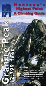
First Ascent Press’s latest offering from the vertical world is a detailed topographic map of Granite Peak with numerous route descriptions. The state’s highest peak, located in the Absaroka-Beartooth Wilderness, is an objective of great interest, and anyone who’s huffed it up to Froze to Death Plateau knows that route-finding is tricky (as a certain O/B editor who shall remain nameless can confirm). The long, strenuous approach, fickle and often extreme weather, and wild, remote setting make it a very serious alpine adventure.
The map’s East Ridge, Northwest Ridge, Southeast Couloir, and North Face routes are cleanly described as is the preferred descent route (East Ridge). Ample aerial photographs greatly aid in route-finding. Publisher Joe Josephson also reiterates vital backcountry regulations and tackles the tricky “human waste” subject head-on. This fragile alpine ecosystem already sees high traffic, so please pack it out. There’s no shame in a poop tube. Pick up your copy at Barrel Mountaineering or Northern Lights, or visit firstascentpress.com.