
Ivory Tower


Winter on Elephanthead.
One of the most enjoyable and scenic one-day ski descents in Greater Yellowstone lies in the north end of the Western Beartooths on a mountain geologist Thomas Jaggar called “a strange looking knob” as he viewed it from the Yellowstone River in 1893. Elephanthead doesn’t dominate the skyline or even break the 10,000-foot mark (9,431), but its strange shape is eye-catching and a descent of Elephanthead is an excellent introduction to ski mountaineering. Although Jaggar thought the mountain was “apparently a huge dike,” Elephanthead actually is a gigantic tilted flatiron of the region’s finest Bighorn dolomite, protruding like an observation deck with the gnarled granite peaks of the Beartooth core as the spectacle.
Elephanthead lies at the southernmost edge of the Western Beartooth limestone formations, where the rest of the overlying sediments were stripped away from the uplifted bedrock. From the head of Mission Creek, the north face of Elephanthead slants upward in a clean 1,200-foot sweep, inviting one to climb above the rolling plains near Livingston, but then denying further access to the Beartooths with sheer south-facing limestone cliffs. (The trail up to the saddle east of Elephanthead actually continues through a break in the cliffs to provide access to the Beartooth core.)
The north face is most inviting with a coat of snow, offering skiers and riders a superb run on an eggshell-like face that steepens from 25 to 40 degrees.
Ascent
From the business loop of I-90 one-and-a-half miles northeast of Livingston, turn southeast onto Swingley Road. Drive about seven miles and turn right onto Bruffey Lane. Drive nearly two miles over a hill and turn right through the 63 Ranch gate onto a narrow two-track road. Taking extra care with the sensitive locals, continue one-and-a-half miles into spectacular Mission Creek, passing through two gates and bearing right at a fork to a trailhead at road’s end. In snowy conditions, the road ends at least a mile shy of the trailhead. With limestone walls towering above, ski the trail one-quarter mile from the trailhead and cross the creek on a log. Bear left at the first two junctions and right at a third. The trail then climbs steeply through gneissic bedrock along the east side of upper Mission Creek before wrapping up and left under the steep northeast slopes of the mountain.
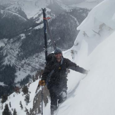
Two routes are commonly used for those on skis. The first option tackles the northeast slopes directly from the toe of the face by following one of four treed ribs, or the open gullies between them. Alternatively, the summer ascent route—bypassing the east face cliffs to climber’s right—also works well with snow. Use extreme caution and choose your day wisely! Any visit to Elephanthead Mountain during the snowy season can be extremely dangerous. All routes have steep sections. Travel in gullies and exposure to large avalanche paths is unavoidable. In particular, be aware of rotten basal snow layers and wind slabs in winter, and dramatic snow softening in spring.
If you have extra time during the ascent or descent, a side trip to the saddle east of Elephanthead yields fabulous views of the range and the rimrock topography of Elephanthead, with fossils galore.
Details
Mission Creek parking elevation: 6,040 feet
Elevation gain: 3,391 feet
Distance: 5 miles
Estimated ascent time: 2 to 4 hours
Map: Livingston Peak
This is an excerpt from Select Peaks of Greater Yellowstone: A Mountaineering History and Guide, published in 2003 by Thomas Turiano, who writes and guides from his home in Wilson, Wyoming.