Maps: MyTopo Waterproof

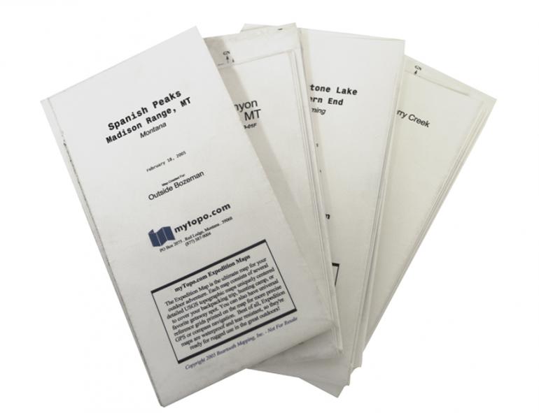
Smartphone apps and GPS devices may be all the rage, but nothing will ever replace the classic topographic map. It doesn’t need batteries or cell service, requires no updates (mountains don’t move much), is inexpensive and replaceable, and can be opened wide for a bird’s-eye view of the terrain. And the Waterproof Topo Maps from MyTopo can even be dropped in a stream or buried in a sloppy snowbank, to no ill effect. MyTopo’s website lets you center your map where you want it, choose the size and scale, select various options (latitude/longitude tic marks, relief shading, etc.), and then opt for either a satellite image or standard contour lines. In a few days, your custom map appears in the mailbox—a physical symbol of adventures to come. I have a dozen of these babies, one for each area I spend lots of time in, and they’re full of notes and X-marks—the meadow where I spotted that huge bull, the pool that held that massive trout, the location of that cool rock outcropping—making it a geographic photo album of all my outdoor adventures.